This is the Comments area. Membership is not required. Comments & Replies are moderated. We only except comments pertaining to subject matter on this website.

The Hunt for Lost French Gold
This is the Comments area. Membership is not required. Comments & Replies are moderated. We only except comments pertaining to subject matter on this website.


 Total Users : 5321
 Total views : 27919
 Your IP Address : 216.73.216.144
Copyright © 2026 Treasure Mountain


We will be running updates from 3-4-22 12:30pm–1:00pm (CT) and backups to platoro.net. It will take approximately 30 minutes.
I will not be able to get up there this year because of my finances and health. I wish everyone “Happy Hunting” for those who get the opportunity. I have several things to post, however – I have ran into a very difficult time in my life and my priorities have radically changed. I am glad to hear LGD got to KC. Hopefully we can get the picture of the marker.
Since January of this year, my health has literally got the best of me. I understand the login form has been down. I am working on it. There has been no way to post any items and I just have finally got all the updates posted.
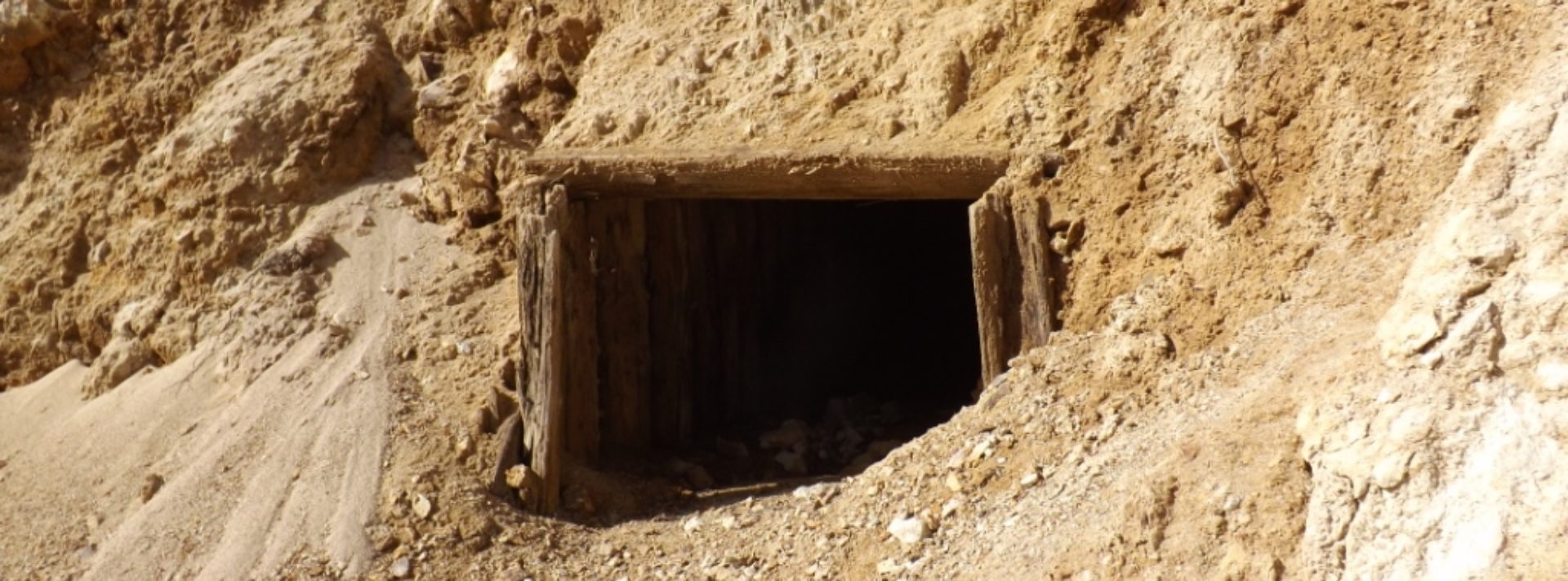
My friend Danny and I were in KC yesterday. We looked for the road marker for Fort De Cavagnial. https://fr.wikipedia.org/wiki/Fort_Cavagnial#/map/0. It must be off more in the wooded area. We couldn’t find it. We are going back next month to locate and take pictures. The actual fort was off on private land. The Kansas Historic Society indicated it cannot be visited but the marker is in the general area. This is where the French might have originally left on there journey to the Rockies.
We will be running updates from 6:00am–7:00am (CT) and backups to platoro.net. It will take approximately 1 hour.
Wishing everyone a safe and Happy 4th of July! May God bless you and yours as you this celebration of Independence Day.
I have added 6 of the 10. It is an ongoing project.
Once you select the view ( use + or – ) by increasing : decreasing the desired view area, click on the open box ( the little icon with 4 small blue arrows pointing outwards ). Then simply click on File and Print. I’ve tried several different browsers – Duckduckgo, Google, so on… It will print just the area you selected. If you pick the little car, you get specific directions that are from Google Maps. The print selection for this is under Menu in the upper left hand corner. Hope that helps. We will be running updates from 8:30am–9:00am (CT) and backups to platoro.net. It will take approximately 30 minutes.
Hello.. I’m not the most tech-savvy person on the planet, so I was wondering when you click on maps and find the one you want to use, how do I print the area I want?
I got two more done. We need a different template. It loads on the cell phones very slow. Also need to put the links in the spreadsheet.
Well how are you doing on the maps? If you need some help, please let me know. The GIF itself has some blur. Just need to snipnclip a new one.
Trying to fix the blur on the main page. Started coding the GPS for all the new maps in the leaflets. It seems to be loading faster. All the footer items will be changed so it will load much faster! We will make sure the Poison Park is the staring point for the map of the Upper Weminuche.
We are working on coordinates with elevation. So far there are 3 members wanting to be at TM in August and possibly PP also for possibly a week. I will revise this post with PP as the coordinates. We are going to change font sizes in the secondary menus. They are clearly to large.
By the way Poison Park Trailhead was Latitude : 37.5336 Longitude : -107.2517 elevation 8800. The number for USDA Forest Service San Juan National Forest, 15 Burnett Court, Durango, CO 81301 (970) 247-4874. Can you have the leaflet show latitude, longitude, and elevation from the map leaflet? The main page JPEG is tad bit fuzzy, just letting you know.
You were right. It loads much faster this way. Used JPEG. Thanks. Yes, the coding and maps are free but still thinking about a paid subscription. But for right now (considering the budget), this will work. It helps visualize the areas with directions for 4×4, hiking, or just plain driving.
The new Leaflet maps are just plain AWESOME! So now you need coordinates in the spreadsheet with links to each specific area. I think the front page should just be a TIF of GIF picture and link it to the Leaflet. On a cell phone, even if you barely tough it while scrolling, it starts decreasing/increasing your view area. But still, this is a great way to evaluate the specific area on the spreadsheet. I like the little car in the upper corner for directions! Cute! I guess I don’t understand the source maps? Are they free?
Last night I spent time talking about LIDAR technology and how it might assist in the search. I am very encouraged with this approach, but the drones are very expensive. We are going to try to figure out a cost effective way to possibly utilize this in 2 specific areas we have searched previously. LIDAR might just be the way to approach some of them more difficult terrains and also go over areas that we have already covered.
Yesterday I spoke with J. Jimmerson again about the French on the east side of the Arkansas river. One thing that he had heard was the French called the area around South Fork “Vent de mort.” It means wind of death. I’ve been in Fairplay in a blizzard. I can’t really think of anywhere in Colorado where the wind and blowing snow is almost completely white out. I am not sure how many times the 285 closes in the winter because of the snow blowing over the roads.
Ouch. Unfortunate mishap for your rig. Bet getting back to civilization was tough. The road to Williams Creek reservoir is so pretty. Talk about best kept secrets! The last time we camped by Poison Park there were huge Black Angus cattle! Have had some pretty good days fishing at the lake (hit n miss) but usually good days anywhere on the south side. And as for the road, you could take the scenic route up on Fourmile (the long way up)! Wonder how far AAA will tow? Bet that cost a pretty penny to get out of that mess.
Comments and Posts to the Forum are moderated. We only except comments or posts that are pertaining to subject matter on this website. If the comment is not related to the website, it is discarded. Also, in the forum, users with email addresses that are cannot be verified, their account information including comments and posts are deleted.
We will be running updates from 4:30pm–5:00pm (CT) and backups to platoro.net. It will take approximately 30 minutes.
Some posts under “Comments” are not being displayed. Are they just being deleted?
And just for kicks, I’ll tell you what happened to me and my friend when we last attempted to go to Poison Park to hike into Hossick Creek. We were attempting to search around the west side of Cimarrona Peak for a couple of days. We were pulling a 4×4 behind a class C motor home and as we began to the trek up Piedra, the outside axle of the 4×4 came out almost 2 feet from the differential into the other side of the road!!!! Apparently, the cotter pin that holds a important lock into the housing had come out and the axle was free to escape! The friend I was with has no French ancestry but I do. It bothered me but I still keep looking and miss it a bunch. Nathrop looks so beautiful today. It is warm and the mountains still glisten with all the snow. It is just breath taking!
September 1? Why can’t we just go today? And so if we get all the stash together, does this mean that we begin to get attacked by the ghosts of Indians, French, Spanish, Mexicans, and others? My last name is French! BUT – I’m in!!!!!!!!!!
Good Morning! The picture has writing in it on the right. It’s not that noticeable. I have the book scanned in but the pages are poorly aligned. His book was never reprinted. I will put it up for members. Get someone with a nice voice for the book. Maybe Brad Pitt, Kevin Costner?!!! How cool would that be? lol. Did you understand the Leaflet. I know the plugin for WP includes 2 free maps but I don’t think Esri is free. The GPS maps are $100.00 per year.
I’m glad your feeling better! You need to take 2 MA pills (mountain air) and call me in the morning! I have some other notes to post. I noticed that some of these items need to be in the forum. I will help. I found the link for the leaflet maps – https://pubs.er.usgs.gov/publication/70014051. I think this is the one you want? Then you could use this on your spreadsheet.